
Cape Wrath + the most remote public toilet in mainland Britain

Cows on the beach, Durness
The third day of Northern Jaunt consisted of exploring the fluffy edges of the west coast. For such a relatively small area – at some points we were barely 60 miles from Inverness – the contrasts in the landscape were mind-boggling. First we headed north from Kinlochewe, along Loch Maree then around the coast to Poolewe then taking the slower coastal route back down to Ullapool. We lucked out with another fine day so could take in all the grey jaggy mountains, white beaches and stonking sea views, with no company but the occasional campervan or motorbike.
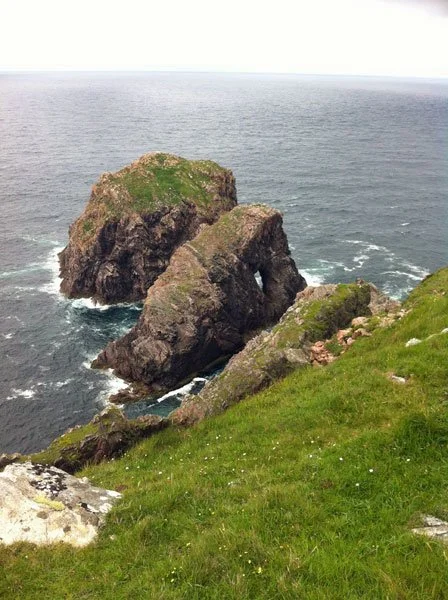
We took a spontaneous detour around the Assynt area, another sticky-out bit north of Ullapool. This is where you trot out words like rugged, dramatic, spectacular then mop the drool from your chin. The weather had turned all misty and moody but that just added to the experience. From Lochinver we went along a crazy single track road that included this sign:

Beware of the toads
Then came dozens of lochs, full of lily pads in full bloom. Gareth said I would regret not stopping for a pic and now I do! It was such a weird sight; like nowhere else in Scotland. I love this country so much. I can’t think of anywhere that packs so much contrast into such a small space.

Confusing.
We took another detour to Stoer Head, where in the middle of bloody nowhere you’ll find a lighthouse, assorted sheep and seabirds, and apparently The Most Remote Public Toilet In Mainland Britain.

Loyalty card
There is some controversy as to the legitimacy of this remote loo claim, but I was busting so didn’t really care.

The remotest loo

View from the loo at the light
Finally we headed north again into Sutherland, where the landscape gets even more spectacular. Total photographic fail there; I had to sit back, shut up and drink it all in. The mountains are grey and rocky and desolate and ancient and you can imagine some epic murderous TV series being filmed there. Ahhhh I loved it so much. Me have no words.
On the fourth and final day we had a quick walk along a beach in Durness…
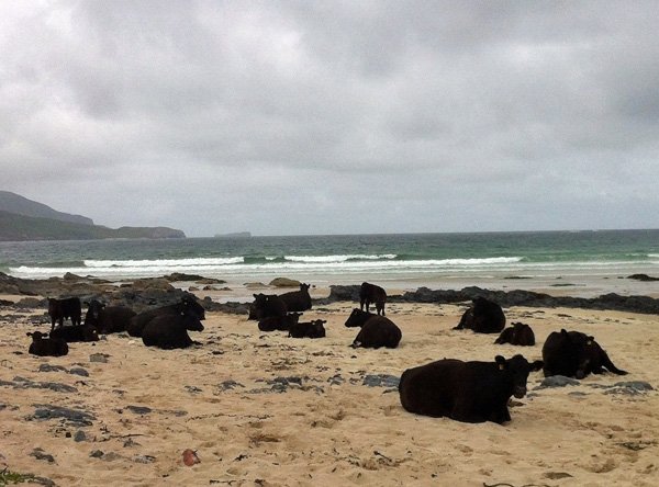
Cows on the beach in Durness

Cowpath
… then on to the main objective: a visit Cape Wrath, the most north-westerly point of mainland Britain. It’s called CAPE WRATH… how can you resist a name like that?
Although part of the mainland you have to catch a ferry to get to Cape Wrath. I feel this wee boat really stretched the definition of ferry…

Cape Wrath ferry
Much of the cape is owned by the Ministry of Defence and is used as a military training area, including a live firing range. We had to wait about 90 minutes once we got over there as they were cleaning up from exploding some top secret things.

You shall not pass
Finally we were able to journey across the bumpy road to the lighthouse…

No neighbours to get in your face
… with some beautiful beaches along the way.

One of the bays on Cape Wrath
… but mostly miles of bleak moorland that’s perfect for testing your evil weapons.
Finally we got to the lighthouse and enjoyed the cliffs and seabirds swirling around…
Next stop, Canada
… plus Mainland Britain’s Most North-Westerly Cheese and Pickle Sandwich.
Please note that there is NO PUBLIC LOO on Cape Wrath (perhaps under threat from the Stoer Lighthouse people). So if you do want to indulge at the cafe, be careful about your beverage consumption.

Mainland Britain's most northerly cheese and pickle sandwich?
Once ferried back we drove the 2.5 hours back to Inverness, which seemed very sedate after all that dramatic scenery.
I spent ages drawing this stupid squiggle to show the trip route now I’ve realised I totally left out CAPE WRATH. I am not going to redo it a 15th time, so just imagine that top left-hand corner is also conquered!

Rough route of the whole journey